Sentry Page Protection

Routes used on the Trek, 1942
|
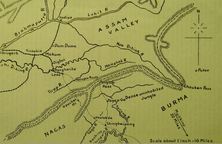
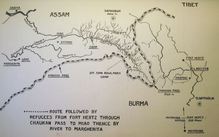
Burma to Assam

|
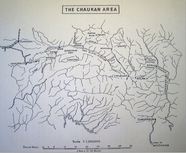
Chaukan Area
|
Refugee Routes
|
|
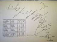
Tagap Ga to Margherita
|
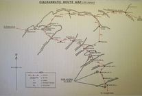
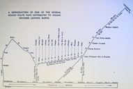
Diagrammatic Route Map
|
Fort Hertz to Margherita
|
|
Route Map Distributed to Indian Refugees
|
Shinbwiyang Routes
|
Tagap Ga to Margherita
|
|
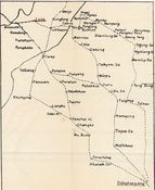
Kelly Family Trek Route 1942
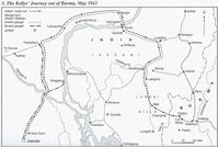
courtesy of Desmond Kelly, author of Kelly's Burma Campaign
|
Tiddim R0ad from Milestone 109

Courtesy of Desmond Kelly, author of Kelly's Burma Campaign
|
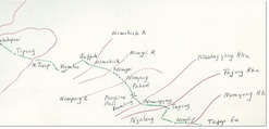
Brooke Family Trek Route
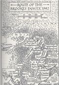
Route of the Brooke's family from the book Through the Jungle of Death by Stephen Brookes
|
|
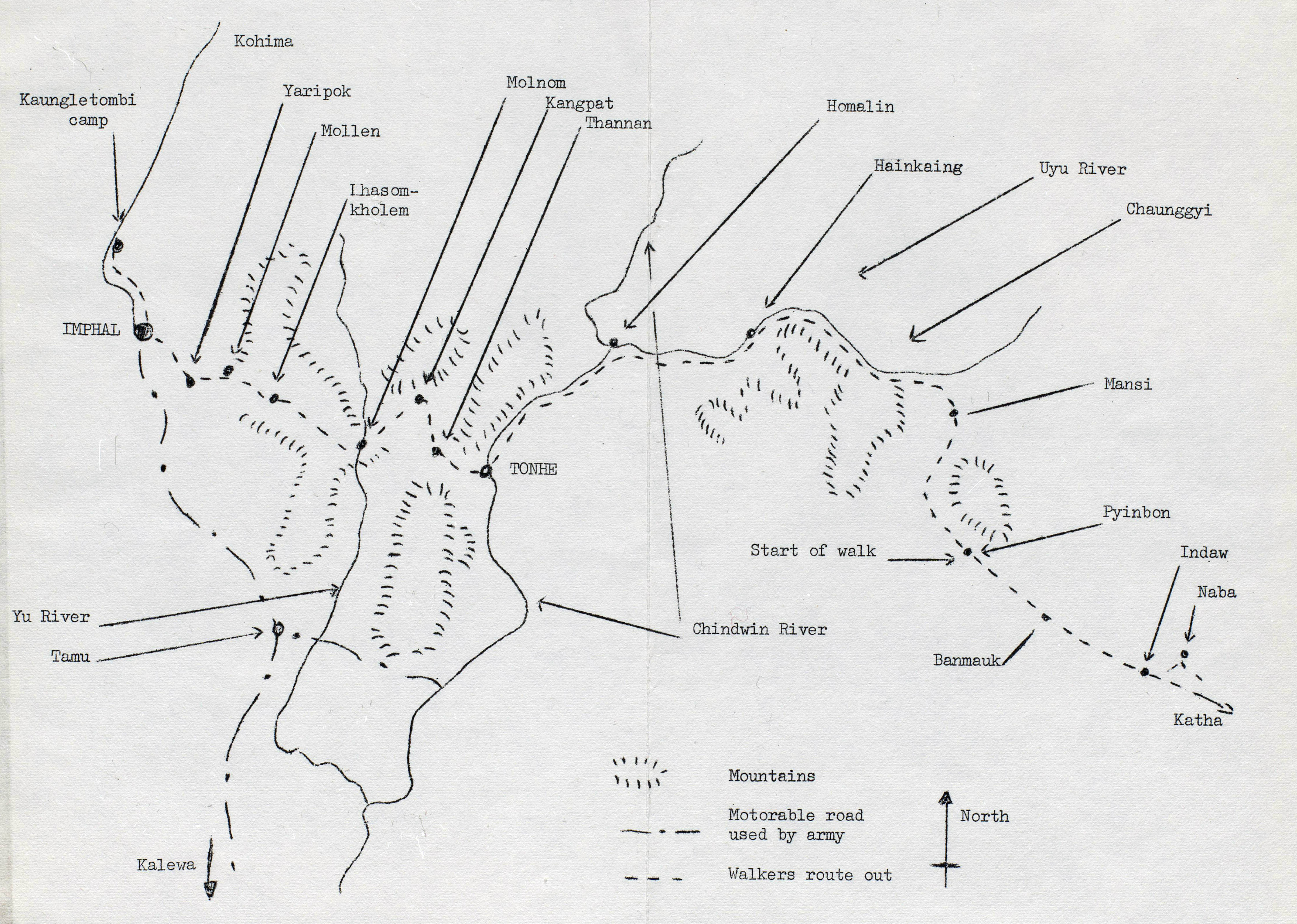
Kalaw to Kaungletombi Camp, India
|
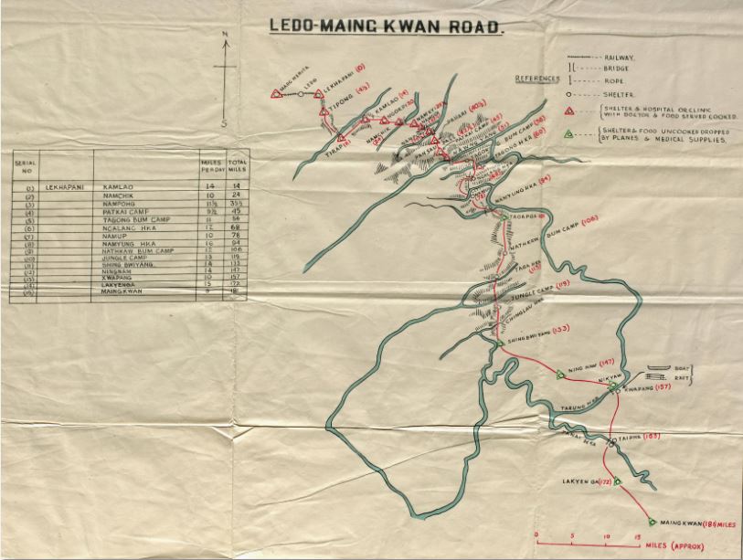
Ledo-Maing Kwan Road
|
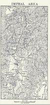
Imphal Area
|
Ariel view of the Hukawng route between Burma and India
after Stilwell had built a motor road in 1944
after Stilwell had built a motor road in 1944
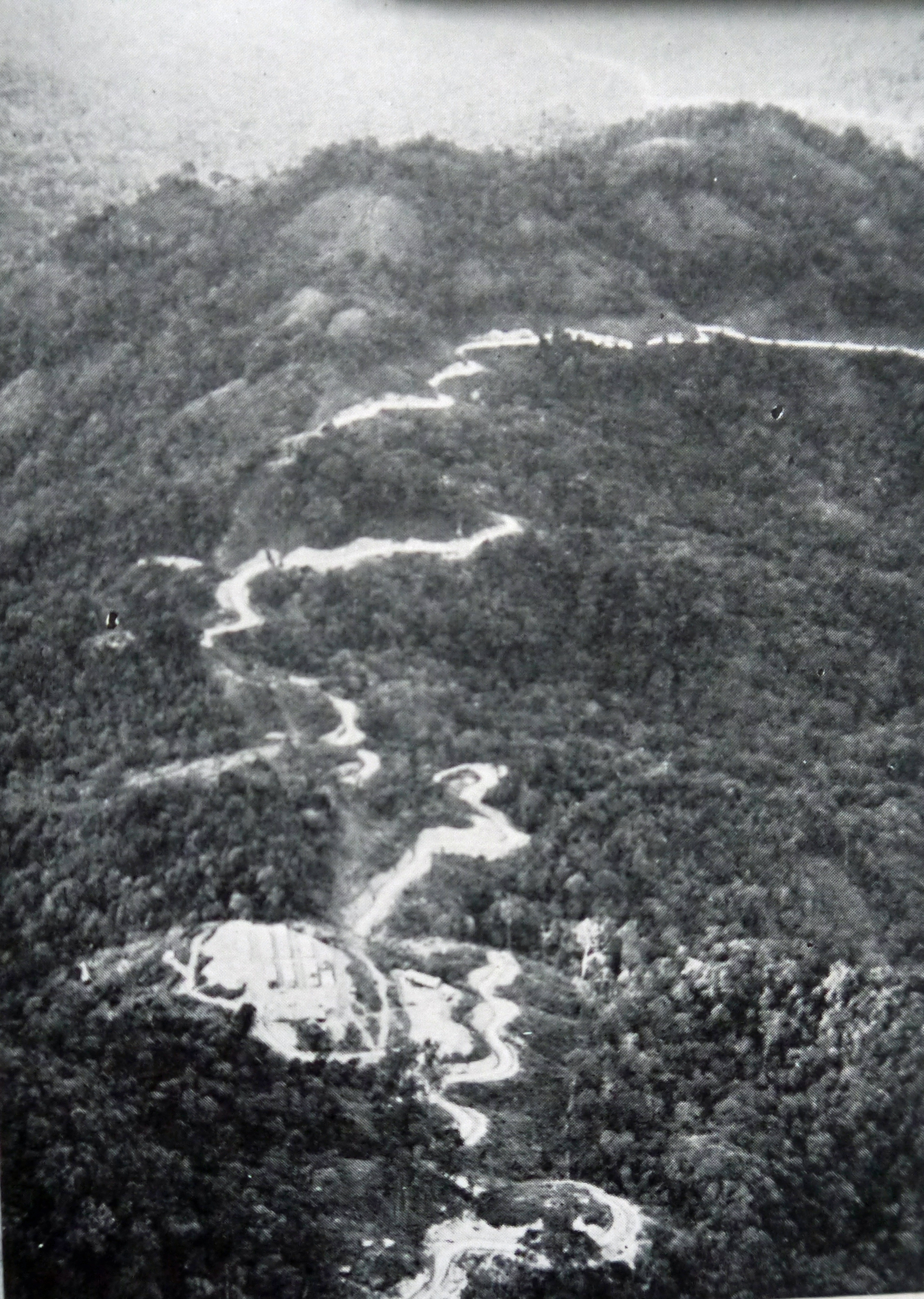
Associated Press photograph